Visiting the Jomon Prehistoric Sites in Northern Japan
Site tours
The Jomon Prehistoric Sites in Northern Japan consist of 17 archaeological sites: 6 in Hokkaido, 8 in Aomori Prefecture, 1 in Iwate Prefecture and 2 in Akita Prefecture. There is also one associated archaeological site in Hokkaido and another in Aomori.
Most of these prehistoric sites are blessed with a rich natural environment that’s characterized by vegetation and geological features reminiscent of the Jomon period, allowing visitors to reflect on the livelihood of people in those days and to enjoy the seasonal natural beauty and various events held there. Another appeal is that people find something new with every visit.
There’s more than one way to enjoy these prehistoric sites. You may want to visit them in order of chronology, type (e.g., settlement sites or stone circles), or location. Or you may choose to revisit your favorites again and again.
On a tour to any of the sites, you won’t want to miss the chance to stop in at the visitor facilities near the site. They provide detailed information on the site and archaeological excavations, and display many artifacts unearthed there, such as pots and clay figurines. Tour guides are available at some facilities.
List of the Component Parts and Visitor Facilities of the Jomon Prehistoric Sites in Northern Japan
(PDF:109KB、Excel:16KB)
Note: When visiting any of the archaeological sites, please observe all the precautions set by each site and visitor facility.
Map of the Jomon Prehistoric Sites in Northern Japan
Hokkaido
-
Kakinoshima Site
-
Kitakogane Site
-
Ofune Site
-
Irie Site
-
Kiusu Earthwork Burial Circles
-
Takasago Burial Site
Aomori
-
Odai Yamamoto Site
-
Tagoyano Site
-
Futatsumori Site
-
Sannai Maruyama Site
-
Komakino Stone Circle
-
Omori Katsuyama Stone Circle
-
Kamegaoka Burial Site
-
Korekawa Site
Iwate
Akita
Associated sites
Note: When visiting any of the archaeological sites, please observe all the precautions set by each site and visitor facility.
(PDF:109KB、Excel:16KB)
Access
Access map
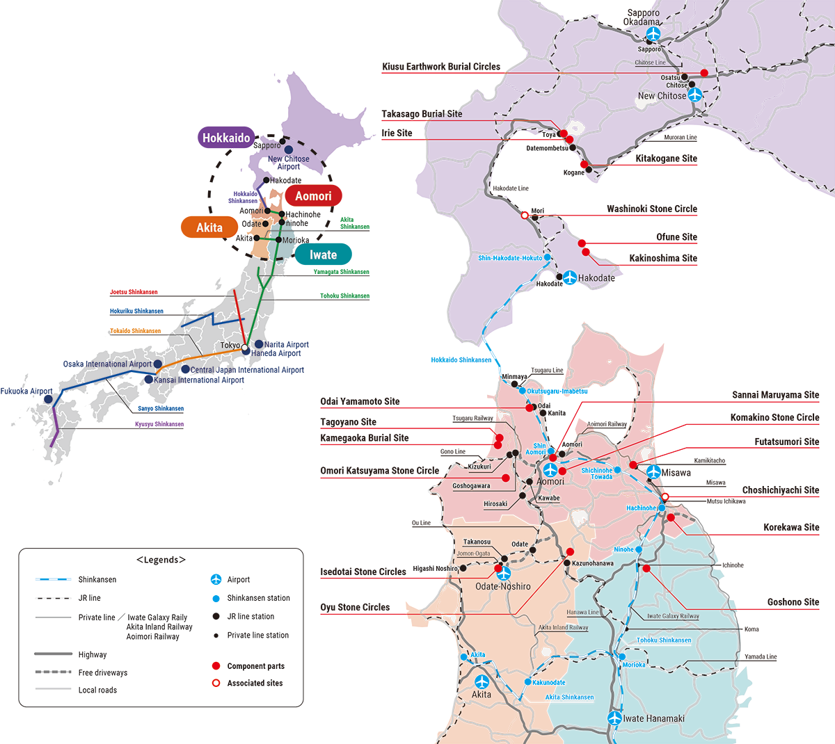
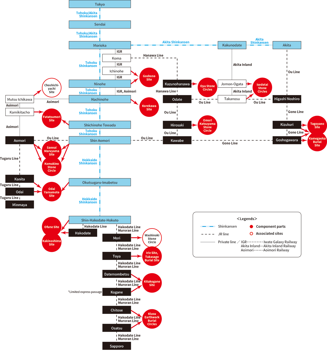
By rail
For access from the nearest station to the archaeological site, see the corresponding site introduction page.
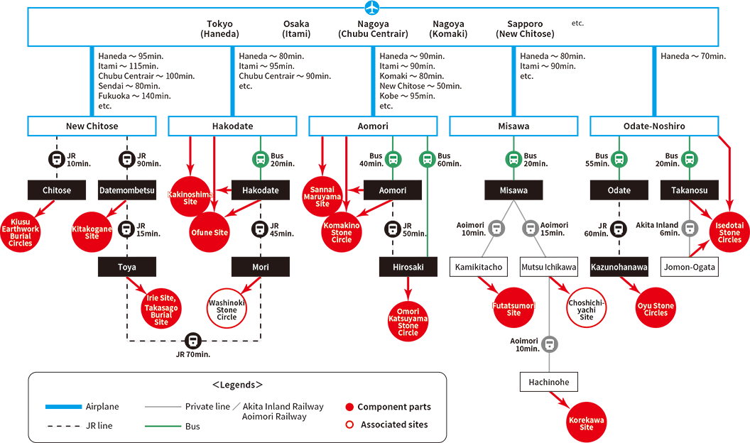
By plane
For access from the nearest airport and station to the archaeological site, see the corresponding site introduction page.
Travel maps
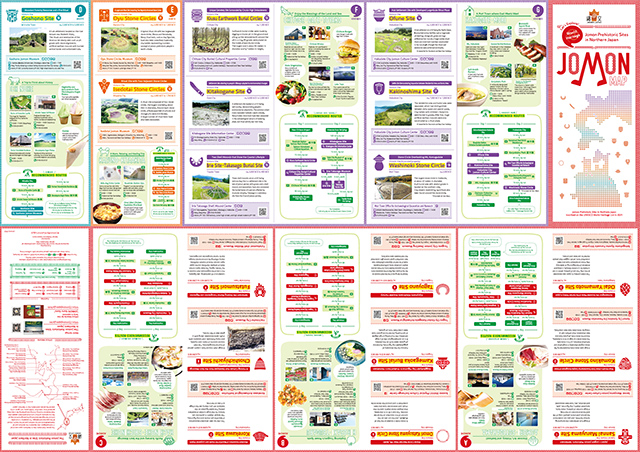
The JOMON MAP is handy for touring the Jomon Prehistoric Sites in Northern Japan. It includes a map of the prehistoric sites as a whole and information on the sites and visitor facilities, as well as recommended tour routes. (published in January 2022)
The JOMON MAP is available at the sites and can also be downloaded from this page (see below).
(The map is in A1 size (594 × 841 mm) and folds down accordion-style to 30 × 12 cm.)
Outside pages
In addition to information on the sites and visitor facilities, these pages introduce tourist spots and local dishes by area.
- Outside pages (all areas) (PDF:11.1MB)
- Cover and back cover(PDF:1.30MB)
- Area A (Aomori and Sotogahama) (PDF:1.59MB)
- Area B (Hirosaki and Tsugaru) (PDF:1.69MB)
- Area C (Hachinohe and Shichinohe) (PDF:1.85MB)
- Area D (Ichinohe) and Area E (Kazuno and Kitaakita) (PDF:2.04MB)
- Area F (Chitose, Date and Toyako) (PDF:1.75MB)
- Area G (Hakodate and Mori) (PDF:1.83MB)
Inside pages
These pages include a map of the prehistoric sites as a whole, with information on access from the nearest stations and airports.
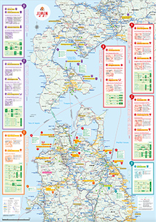
- Inside pages (overall map) (PDF:15.5MB)
- Upper right of the map(PDF:11.4MB)
- Upper left of the map(PDF:9.89MB)
- Lower right of the map(PDF:7.05MB)
- Lower left of the map(PDF:6.82MB)
